topographycal survey services
We are specialists in providing topographical survey data and using the up to date instruments and software to ensure a fast and cost effective field to finish solution. This data can be supplied in various formats such as AutoCAD, and other data format as per client requirement.
We are experienced in supporting our clients with the full range of topographic surveys,geomatic surveys and throughout Indonesia.
Our product such as:
We are experienced in supporting our clients with the full range of topographic surveys,geomatic surveys and throughout Indonesia.
Our product such as:
- 3d Digital Terrain Modelling
- Contouring and levelling
- Large and small scale mapping
- Tree tagging and schedules
- River sections
- Flood risk analysis data
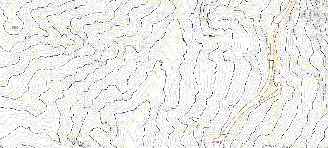
TOPOGRAPHIC MAP
ENGINEERING SURVEY SERVICES
We have a background in design engineering and construction contracting and civil, mechanical engineering projects, make us a detailed understanding of the survey needs and requirements of the design & construction team. As experienced engineering surveyors, we have a proven record of providing accurate engineering surveys for use in design and construction of structural, infrastructure, transportation, environmental and civil & Mechanical engineering schemes.
We can provide accurate and reliable dimension data throughout the construction process from the base topographical survey, cross-sections and ground modelling information to cut and fill calculations, dimensional control to setting-out on-site and finished as-built drawings. The range of projects undertaken have also include more specialist engineering surveying such as railway projects, coastal erosions, tunnelling and restricted access site.
We can provide accurate and reliable dimension data throughout the construction process from the base topographical survey, cross-sections and ground modelling information to cut and fill calculations, dimensional control to setting-out on-site and finished as-built drawings. The range of projects undertaken have also include more specialist engineering surveying such as railway projects, coastal erosions, tunnelling and restricted access site.
- Volumes calculations
- Stockpile surveys
- Cut/Fill calculations
- Areas calculations
- Pile setting-out
- Land parcel surveys
- Precision positioning
- Noise Surveys
- Setting-out for construction
- Dimensional control
- As-built record surveys
- Site engineering surveys
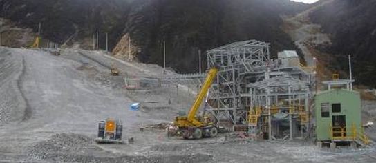
CONVEYOR
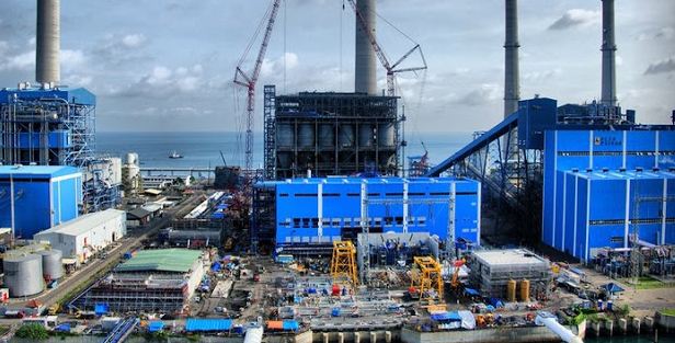
POWER PLANT
BUILDING - CONSTRUCTION SURVEYING SERVICES
We provide the complete range of measured building survey services including; floor plans, sections, structural details and elevations, dimensional control etc.
Each element of the property can be surveyed independently or as part of a fully connected co-ordinated survey which will reference the floor plans, elevations, topographical surveysand underground investigation to a common grid and level datum. This data provides an essential 3d resource for architects and designers whether for refurbishments, alterations or record purposes
We provide professional surveyor to support the construction surveying.
Monitoring Surveys/DEFORMATION SURVEY - services
HIGH PRECISION DEFORMATION SURVEYS ARE USED TO DETECT SLIGHT MOVEMENTS IN STRUCTURES AND SURFACES, TO ENSURE THAT HEALTH, SAFETY, AND ENVIRONMENTAL CONSIDERATIONS ARE MET.
We are experienced with high precision survey equipment, data collecting procedures and proprietary software allowing us to design, build and maintain a Deformation Monitoring system for a variety of projects, such as:
We are experienced with high precision survey equipment, data collecting procedures and proprietary software allowing us to design, build and maintain a Deformation Monitoring system for a variety of projects, such as:
- Water Retention Dikes
- Hydro-Electric Dams
- Open Pit High Walls
- Construction Retaining Walls
- Air Strip and Construction Surfaces
- Fuel Tank Side Walls
- River Banks and high Erosion
- High Rise Building
- Movement monitoring
- Precise levelling
- Deformation monitoring
- Measuring real-time or over long periods
- Ground water monitoring
- 3D XYZ coordinate differences
- Crack monitoring
